- Islands
- Seven, from Colaba to Mahim
- First major work
- Hornby Vellard, Worli, 1780s
- Portuguese rule
- From 1534 to 1661
- Colaba link
- Causeway built in the 1830s
The seven islands
Mumbai began as a group of seven islands: Colaba, Old Woman's Island, Bombay, Mazagaon, Parel, Worli and Mahim. Between them lay creeks, mudflats and shallow channels that filled and emptied with the tide. Koli fishing communities lived along these shores long before any chart was drawn, and their shrines and landing places still mark the water's edge. The city's name comes from the goddess Mumbadevi, whose temple stands in Bhuleshwar, north of the oldest settled ground.
The islands were not empty ground waiting to be joined. Each had its own character: Colaba a southern outpost, Mazagaon and Parel low and green, Worli and Mahim held apart by a wide channel. Travel between them meant boats, fords at low tide, or long detours. That separation shaped everything that followed, because the work of joining them was not one engineering project but a habit, repeated across two centuries, of pushing the sea back and building on what was left behind.
Portuguese years and English hands
The Portuguese held the islands from 1534, when the Sultan of Gujarat ceded the territory around Bassein. They built churches, encouraged rice cultivation and left a Catholic population whose descendants, the East Indians, still live in the northern villages and in Bandra. Portuguese place names survive in odd corners of the map, and the sea defences they began at Bandra were later rebuilt. Their rule was long enough to change the land, but not long enough to join it into a single place.
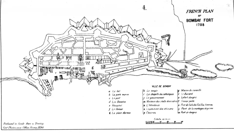
In 1661 the islands passed to England as part of Catherine of Braganza's dowry on her marriage to Charles II, and in 1668 the Crown leased them to the East India Company. The Company moved its western headquarters here from Surat, and the settlement grew around a fort and a bazaar. Defence, trade and land were tangled together from the start: the fort needed open ground around its walls, and that ground was mostly tidal.
The Hornby Vellard at Worli
The best known early work is the Hornby Vellard at Worli, built in the 1780s under Governor William Hornby. A vellard is a sea wall or causeway, and this one was meant to close the breach between Worli and the main island, stopping the sea from flooding low ground at Mahalaxmi. The first attempt failed, and the project went ahead against doubts in London. The wall changed the movement of the tide and began the silting that made later reclamation easier.
What the vellard did was turn a channel into ground that could be drained and built on. The flats behind it were used for pasture and later for the racecourse and the mills. The pattern set here, a wall first and buildings later, repeats across the city: a line is drawn against the tide, silt gathers behind it, and the new land is leased or sold. Along Bhulabhai Desai Road today, the sea sits further off than the oldest maps suggest.
Reclamation and the southern shore
The largest changes came in the 19th and early 20th centuries. Reclamation turned the Back Bay into the sweep of Marine Drive and gave the city the Oval Maidan, the High Court, the University and the Rajabai Clock Tower on ground that had once been water's edge. The Colaba Causeway, built in the 1830s, joined Colaba and Old Woman's Island to the main island, and the road over it became one of the busiest shopping streets in the south.
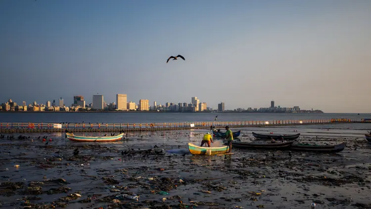
Reclamation also made the docks. Sassoon Dock at Colaba, built in 1875 by the Sassoon family, stands on made ground, and Koli fishing boats still land their catch at dawn nearby. Further north, the mill districts of Parel and Worli rose on filled land. Each generation added a little more: a sea wall, a road, a plot. On the map, the southern tip of the city reads as a piece of engineering as much as a piece of geography.
- The Colaba Causeway links Colaba and Old Woman's Island to the rest of the city.
- The Oval Maidan and the buildings around it stand on ground reclaimed from Back Bay.
- Marine Drive follows a sea wall that holds the western edge of the Back Bay reclamation.
- Sassoon Dock, built in 1875, sits on made ground at the southern end of Colaba.
- Streets that bend for no clear reason often follow the line of a filled creek.
Causeways, bridges and the railway
Joining islands needed roads as much as walls. The Mahim Causeway, built in the 1840s with money from a Parsi philanthropic family, linked Mahim to Bandra and made the northern villages reachable by cart. The Sion Causeway did similar work on the eastern side. Then came the railway: the first passenger trains in India ran from Bori Bunder to Thane in 1853, and the embankments and bridges that followed tied the suburbs to the island more tightly than any road.
Each link changed the city's centre of gravity. Once Bandra and Thane were a train ride away, the southern tip stopped being the whole city and became its historic quarter. The instinct is unchanged. The sea link between Bandra and Worli, opened in 2009, and the Mumbai Trans Harbour Link, opened in January 2024, do the same work in concrete and cable. Connect first, then build along the connection: the pattern runs from the vellard to the sea link.
Reading the old shoreline in Colaba
Colaba is a good place to see the layers. The causeway is now a shopping street, and the land either side of it is entirely made. The Gateway of India, begun in 1913 and completed in 1924, stands on reclaimed ground at Apollo Bunder, facing the harbour where ferries leave for Elephanta. Behind it, the Afghan Church, begun in 1847 and consecrated in 1858, remembers soldiers who died in the First Anglo-Afghan War.
Walking here, the sea is never far, but the shoreline is not where the first charts put it. Streets curve where creeks once ran, and some plots sit a little higher than their neighbours because they were filled at different times. The name Fort survives for a walled town that has gone, its ramparts taken down in the 1860s and the land sold for offices and warehouses. The city keeps editing itself.
- Apollo Bunder, where the Gateway of India stands, is land built out into the harbour.
- The Afghan Church, consecrated in 1858, was built when Colaba was still thinly settled.
- Colaba Causeway began as a link across water and is now a shopping street.
- The Fort's ramparts were removed in the 1860s, and the land became the office quarter.
Editorial review: 16 November 2026 · imptmumbai.in, written with AI assistance (see the editorial policy).