- Sea Link opened
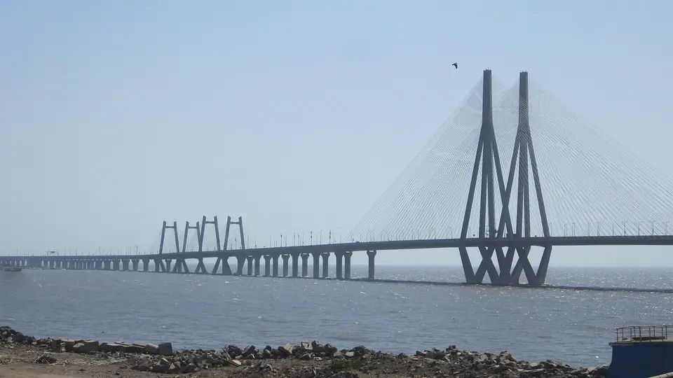
- 2009, linking Bandra and Worli
- Atal Setu
- Opened January 2024, about 22 km
- Coastal road
- Opening in stages from 2024
- Related area
- Worli, south end of the Sea Link
Three ways across the water
Mumbai's western shore has always been a place of crossings. For most of the city's history, getting from the island city to the northern suburbs meant following the coast road through Mahim or crowding onto a train. From 2009 the Bandra-Worli Sea Link carried traffic over Mahim Bay. In January 2024 the Atal Setu opened across the harbour to Nhava Sheva. From 2024 the Mumbai Coastal Road began opening in stages along the western shore.
Each of the three changed a different journey. The Sea Link shortened the run between the western suburbs and Worli. The Atal Setu put the mainland across the harbour within reach of the eastern shore. The coastal road gave the island city a fast north-south route where there had been a slow line of traffic signals. Together they rearranged how residents and visitors think about distance in a city built on a narrow peninsula, and they changed what a drive along the western edge can show you.
The Sea Link at Worli
The Bandra-Worli Sea Link opened in 2009 and runs over Mahim Bay, joining the Bandra shore near Land's End to Worli. Its towers and cables are visible from both sea faces, and from the water on a ferry or a fishing boat. Drivers cross quickly, but the crossing is worth noticing: the bay below holds fishing boats, the Bandra Fort sits at the northern end, and on a clear day the line of the western suburbs runs north.
Traffic rules on the Sea Link are strict. Stopping on the carriageway is not allowed, so the views are for passengers rather than drivers. Two-wheelers, autorickshaws and pedestrians are kept off the bridge, and the wind on the cables can be strong in the monsoon. Photographs from a moving car are difficult, and stopping to take one is not an option. Views open up from the Worli sea face, from Bandra Fort and from the water.
Atal Setu across the harbour
The Mumbai Trans Harbour Link, named Atal Setu, opened in January 2024 and runs about 22 km from Sewri on the eastern shore of the island city to Nhava Sheva across the harbour. It is the longest sea bridge in India. For a visitor, the crossing is a different kind of sea journey: mudflats and flamingo habitat at Sewri on one side, the container terminals and hills of Navi Mumbai on the other.
The bridge has changed the eastern approach to the city. Traffic that once crawled through the eastern suburbs or queued for a ferry now crosses the harbour directly, and the run to Navi Mumbai, Panvel and the airport at Navi Mumbai is shorter. The link also shifted attention to Sewri, a working port area with a fort, an old cemetery and the mudflats. Much of the route is a fast, exposed crossing with little shade and no stopping.
- Sewri has a fort, an old cemetery and mudflats where flamingos feed in the cooler months.
- The crossing links the island city with Navi Mumbai, Panvel and the mainland beyond.
- A toll applies on the Atal Setu; check the current rate with the road authorities.
- The bridge is an access-controlled expressway, so check which vehicles are allowed.
The coastal road
The Mumbai Coastal Road runs along the western shore of the island city and opened in stages from 2024. It connects the Worli end of the Sea Link with the southern tip of the city through a mix of elevated stretches, tunnels and reclaimed land. For the traveller, it does two things at once: it moves traffic quickly past the sea face, and it creates new public space at the water's edge where there used to be only road.
Parts of the route carry the sea on one side and the city on the other, and driving it gives a clear view of how narrow the island is. Sections open at different times, and the connections to the Sea Link, to Marine Drive and to the southern roads have changed more than once. Check which stretches and interchanges are open before planning a drive, because the road is still being completed in places.
Worli, where the crossings meet
Worli sits where all three projects meet. The Sea Link lands here, the coastal road begins or ends here, and the older roads of the island city pass through. It is also one of the city's oldest places: the Hornby Vellard at Worli, built in the 1780s, was among the first works that joined the seven islands. The village of Worli Koliwada keeps a fishing community on the point, and Haji Ali Dargah lies just south on its islet.
A drive through Worli passes the Mahalaxmi temple on Bhulabhai Desai Road, the Nehru Science Centre and planetarium, and the sea face with its promenade and tetrapods. The dargah at Haji Ali is reached by a causeway at low tide, and the temple at Mahalaxmi is busiest at Navratri. Allow time to stop rather than treating Worli as a point on a map between two bridges. The sea face itself is a good place to watch the bridge light up after dark.
- Haji Ali Dargah is reached by a causeway that is covered at high tide.
- The Mahalaxmi temple on Bhulabhai Desai Road is busiest during Navratri.
- The Nehru Science Centre and planetarium at Worli suit families on a hot afternoon.
- Worli Koliwada is a working neighbourhood; walk quietly and give the boats room.
Crossing well: practical notes
The crossings are fastest outside peak hours, when the island city's roads and the bridges themselves fill up. All three carry restrictions: no stopping on the bridges or on the coastal road carriageway, and no pedestrians or two-wheelers on the sea links. Toll rules and vehicle classes change, so check before you set out. On the coastal road, some stretches and exits may be closed while work continues. In the monsoon, spray and wind make the exposed sections uncomfortable, so check for closures.
For a visitor without a car, the crossings still matter. They shape which routes are fast and which neighbourhoods sit close together. An app cab across the Atal Setu turns the eastern shore into a day trip; the Sea Link puts Bandra and Worli minutes apart. Ferries from the Gateway of India to Elephanta and Mandwa are a separate pleasure, and they are suspended in rough monsoon weather, so check before you go.
Editorial review: 16 November 2026 · imptmumbai.in, written with AI assistance (see the editorial policy).